32 Frederick Street
2 History - The Area
Discovering the history of a house can be very rewarding and will also provide useful information, especially with regards to its original construction and materials. Historical research can often show where alterations have been made to a building or give clues to why defects have occurred. It may be necessary to do some historical research into a building as part of a survey.
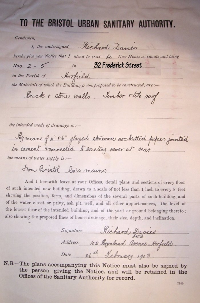 |
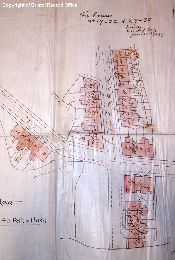
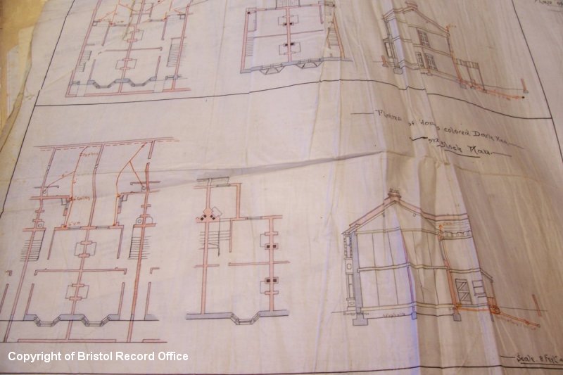
32 Frederick Street was built in 1903 - the beginning of the Edwardian period. This period was an active time for private house builders across the country; in fact, the same year saw a national peak in house building. Largely this was speculative building to meet demands for new rented housing for the rising urban population. The original application (left) to build No 32 was submitted to the Bristol Urban Sanitary Authority on the 26th February by a local builder Mr Richard Davies, who planned to construct a total of four new houses on the street. Most of the houses on Frederick Street had been built earlier just before the turn of the century (right-hand plan shows houses built in 1899), but it was in 1903 that Mr Davies snapped up his building plots, one of which became No 32. The house was fairly modest in size but well-built and most likely would have been a respectable address for the working classes. |
 |
|
|
A good starting point for researching the history of a house and its
locality is at the
local Record Office. Sources might include original Building Plans,
Highway Notices and old Ordnance Survey maps for the area. For Frederick
Street we were able to access these records at Bristol's City Record
Office (www.bristol-city.gov.uk/recordoffice). Staff at the Record
Office are usually able to give good advice on how to start your search if
you visit. It is worth taking a digital camera to record any findings.
Other good sources of information are local libraries and regional
newspaper offices where often you can
search the local history section for books, maps or old photographs.
|
 |
|
|
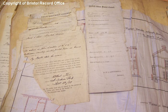
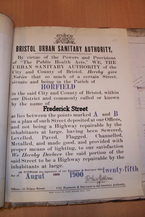
The records show that the Street itself has officially existed since 1900, having been Sewered, Levelled, Paved, Flagged, Channelled, Metalled, and made good, and provided with proper means of lighting, (see original Highway Notice 1900 right and left) the Bristol Urban Sanitary Authority were satisfied that the street be officially recognised within the Parish of Horfield. The area of Horfield where Frederick Street is located is much older. First mentioned as 'Horefelle' in the Doomsday Book, by 1778 it was recorded to have a population of 125, most dwellings situated around the Church and the Common which extended for 34 acres, some of which is still there today. The area was notorious for its forest, called Horwood which was said to shut out all communication with surrounding villages. There existed a long tradition of belief that it was not safe to pass that way singly at night and travellers would wait to form parties before venturing through the forest! (Amesbury et al, 1997). |
|
|
|
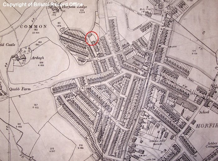
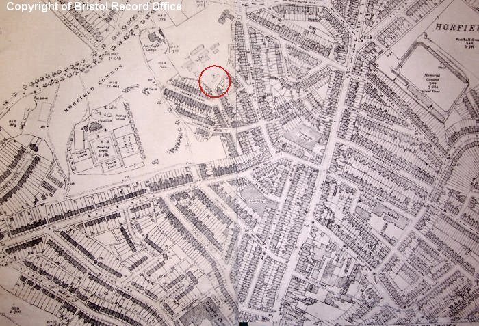
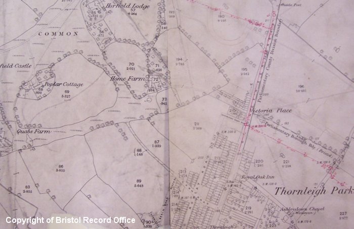
As late as the 1880s Horfield was still largely a rural village and a suburb of Bristol, described as a 'valley with gorse and furze, fields rich with cowslips and bluebells, streams and cattle' (Winstone, 1977). An early OS map of 1881 (left) shows Horfield Common surrounded by fields, dotted with farms. Mass building was underway by the late 19th century and importantly by 1880 the stream tram had reached Horfield bringing a transport connection between residents and their work in the City. In 1885 Bristols boundaries were extended and Horfield was including in this expansion. By the turn of the century Frederick Street was taking shape, built on the old Beehive Estate. The OS map of 1903 (right) shows the encroaching streets (Frederick Street circled in red) impinging on the fields and pastures of the Parish. |
 |
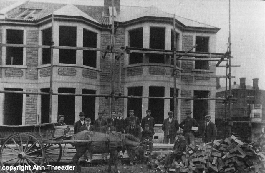 |
The period when Frederick Street was built was a time of changes in the economics of the housing market in the country, the real cost of housing fell, materials became cheaper and more standardised. There was a boom in speculative house building (photo left shows houses going up in a nearby street in 1903) and the self-contained terrace house, like Frederick Street, dominated working-class housing in England by the turn of the century. Described as a through house with back addition the layout was common across Bristol especially in other working-class areas of housing such as Bedminster and Easton. The later OS map of 1948 (right) shows the growth in the area, the Common is still visible but has been largely surrounded by Victorian streets. |
 |
except where acknowledged